")
Organized by: FAFCYLE, Dirección de Defensa del Ambiente (DdA), Capgemini, and the University of Salamanca (USAL)
See Instagram Post
The TREEADS project, under its holistic fire management mission, successfully hosted a three-day intensive drone training course aimed at enhancing wildfire prevention and response through UAV technologies.
Course Overview
The course brought together 28 professionals from national institutions, environmental authorities, and industry experts to explore the operational use of drones in forest fire scenarios.
March 10 & 11: Two full days of online theoretical instruction, covering:
-
Certification preparation for open category A1/A3 (AESA-compliant)
-
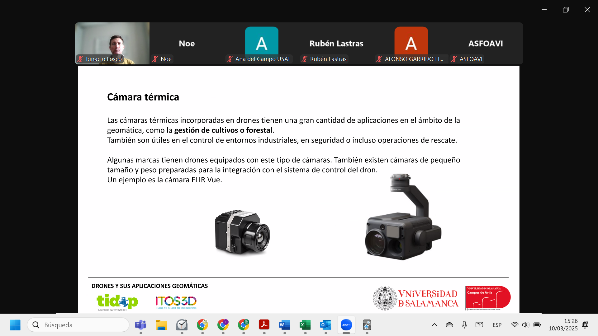
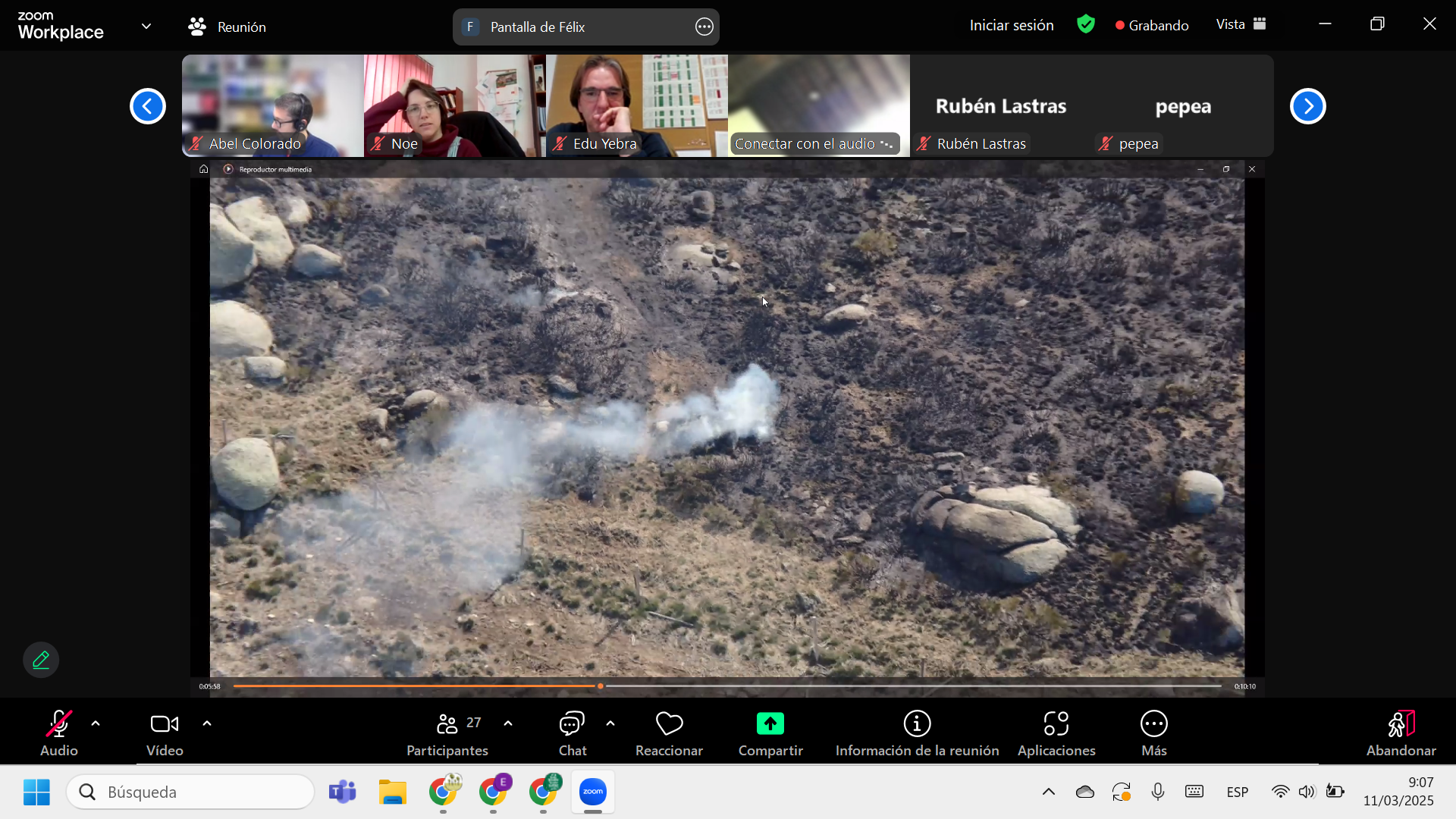
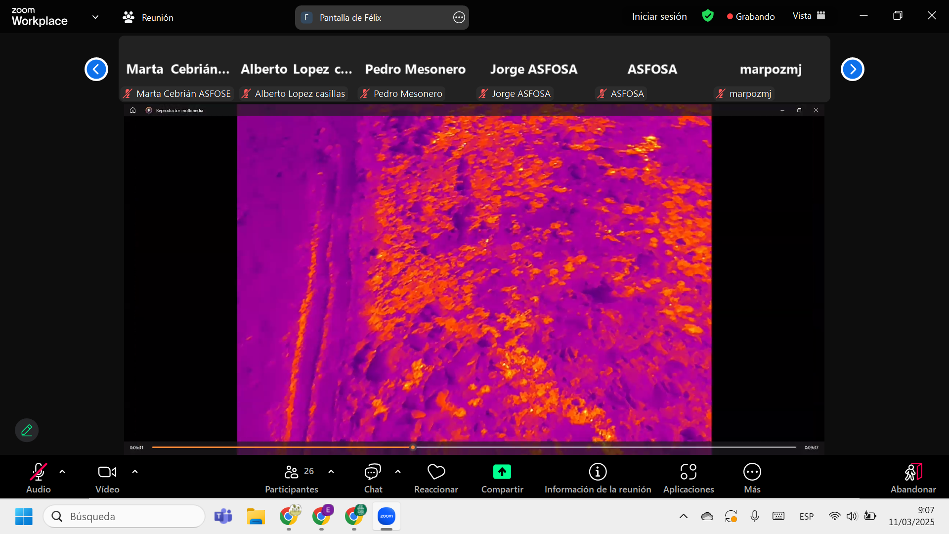
Fundamentals of photogrammetry (visible, thermal, multispectral)
-
Mission planning, execution, and data processing
-
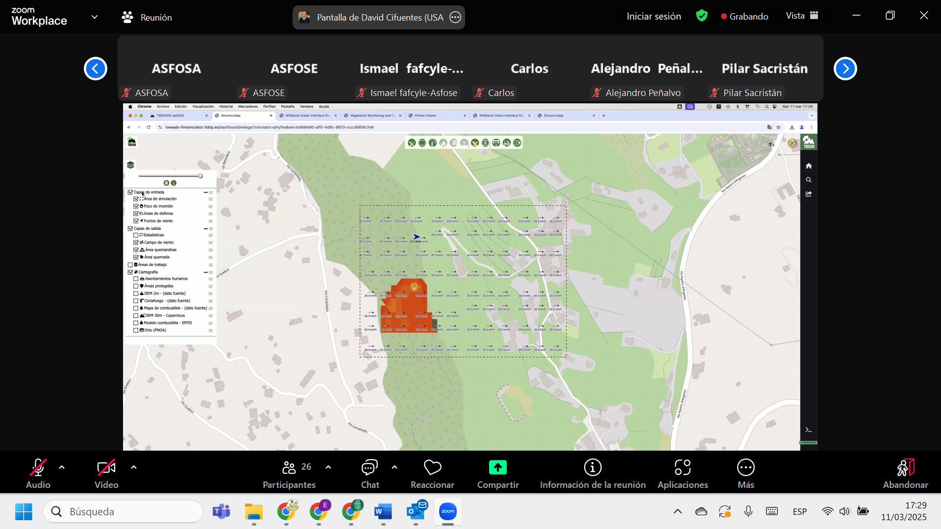
Geospatial analysis using QGIS and integration with the TREEADS platform
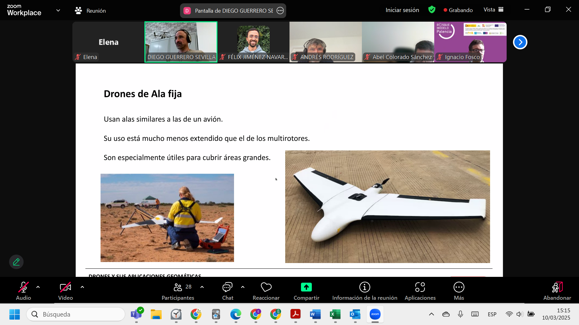
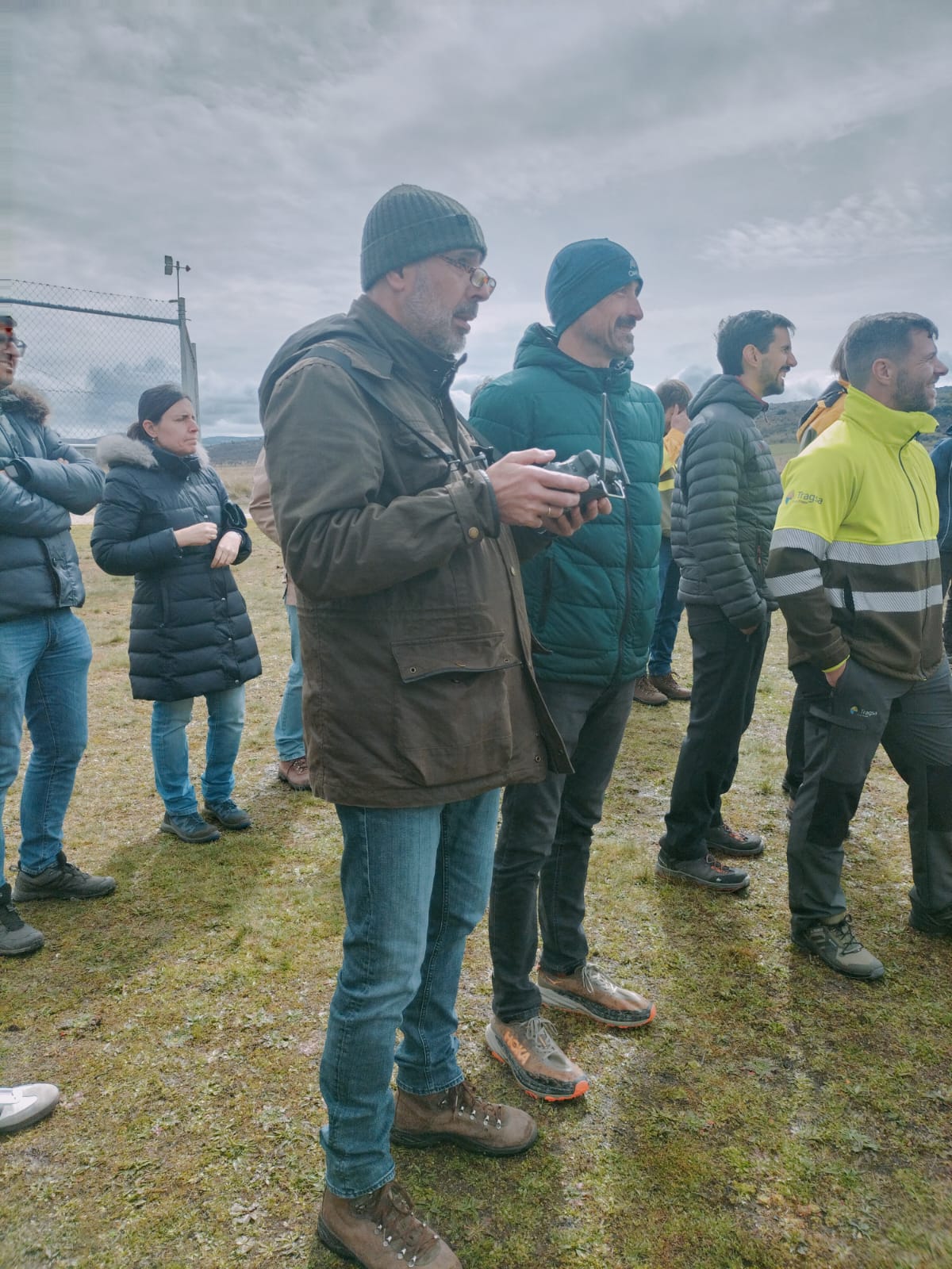
March 13: A hands-on field session at Ávila Aerodrome, where participants conducted real UAV missions, applied flight techniques, and evaluated data in practical wildfire management scenarios.
Objectives & Outcomes
Participants gained skills to:
-
Operate drones safely and legally in open categories
-
Collect, process, and interpret UAV imagery
-
Apply geospatial products in fire prevention, restoration, and monitoring
-
Use TREEADS as a decision-support tool in real-world settings
Stakeholder Engagement
The event sparked high interest among national, regional, and local environmental authorities. Many requested follow-up material and access to the TREEADS platform, showcasing the course’s strong dissemination impact under WP10 and WP8 of the project.
Highlights
-
Hybrid format combining online learning and field practice
-
Hosted by Universidad Politécnica de Ávila
-
Strong collaboration between academia, public institutions, and technology providers